
Mýrdalsjökull Glacier
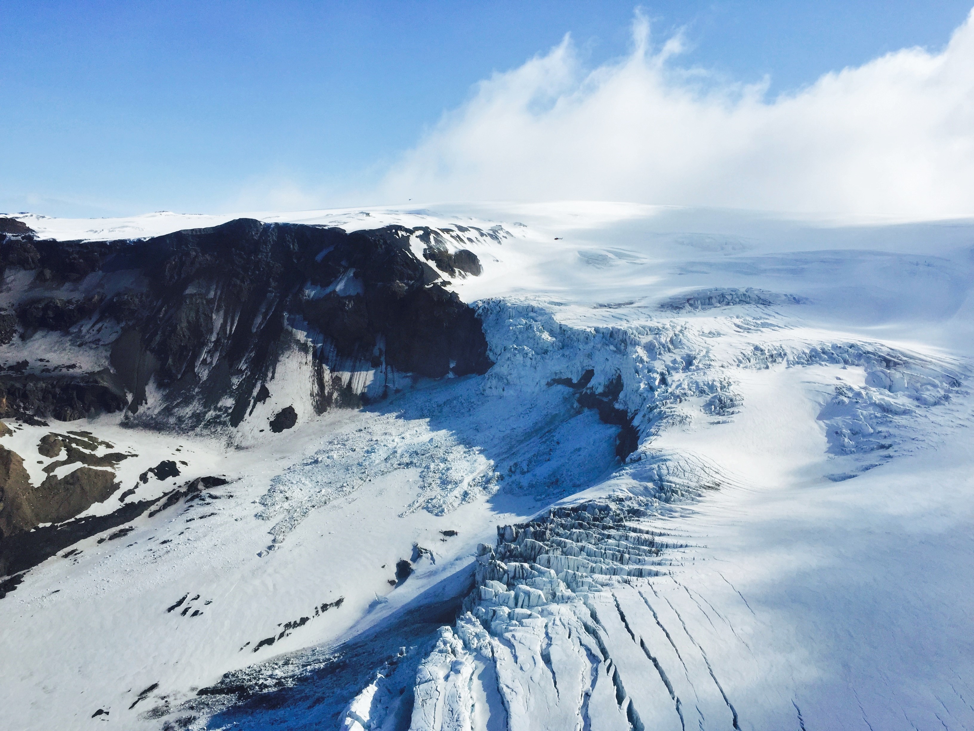
Mýrdalsjökull is Iceland's fourth-largest glacier, an ice cap covering nearly 600 square kilometres of the South Coast highlands just north of the village of Vík. Beneath its ice lies Katla, one of Iceland's most powerful and closely monitored volcanoes, a pairing of fire and ice that makes this one of the most geologically dramatic settings in the country. Its outlet glaciers, Sólheimajökull and Kötlujökull, are the access points for glacier hiking and year-round ice cave tours.
Iceland's Fourth-Largest Glacier, Sitting Above One of Its Most Restless Volcanoes
Mýrdalsjökull covers approximately 596 square kilometres of the Icelandic South Coast highlands and reaches a peak elevation of around 1,450 metres. Its ice averages 225 metres thick, with some sections exceeding 700 metres deep. The glacier caps the Katla volcano, which has erupted roughly every 40 to 80 years throughout recorded history. Katla's last confirmed major eruption was in 1918, producing a catastrophic glacial outburst flood, known as a jökulhlaup, that swept an enormous volume of ice and meltwater across the southern sandur plain to the sea. Katla has shown signs of unrest periodically since then and is considered overdue for another significant eruption by volcanologists. Evacuation routes and early warning systems are in place throughout the area.
The glacier's two main outlet glaciers offer very different visitor experiences. Sólheimajökull, the western tongue, is the most accessible, reached via a short drive off Route 1 near Skógar and an easy walk to the glacier face, and is the main base for guided glacier hikes and ice climbing. The crevasse fields and towering ice formations on Sólheimajökull have made it one of the most popular glacier hiking destinations in Iceland. Kötlujökull, to the east, is the source of the year-round Katla Ice Cave tours, which depart from Vík and travel by super jeep to reach cave entrances within the glacier. Because the ice here forms from a mix of volcanic ash and glacial ice, the colouring inside the caves can be strikingly dark and otherworldly rather than the clear blue of glaciers formed purely from snowfall.
Mýrdalsjökull is visible from the Ring Road as you pass Vík, and the glacier's flanks are a constant presence on the South Coast skyline. It sits roughly 180 kilometres from Reykjavík, about 2.5 hours by car along Route 1. Walking on any part of the glacier without a certified guide is not permitted and is genuinely dangerous due to hidden crevasses and the volcanic hazard. All reputable tour operators in the area hold the necessary certifications and carry rescue equipment.

